24-05-2017 Lanzarote Highlights
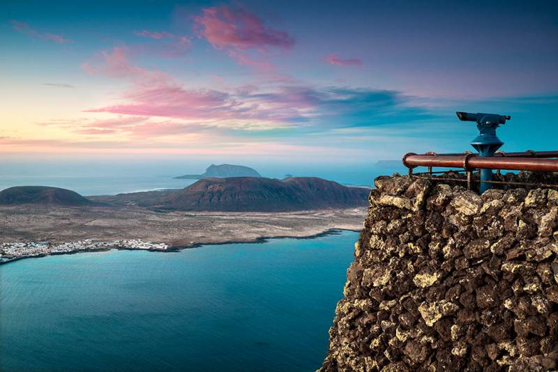
Mirador del Rio
The Mirador del Río represents one of the most characteristic architectural creations of César Manrique. It is located at the top of Risco de Famara, 474 meters above sea level, in the northernmost part of the island. From here we can enjoy one of the most spectacular panoramic views of Lanzarote: Natural Park of the Chinijo Archipelago and the Famara Risco (cliff). The technical realization of the work was carried out by the architect Eduardo Cáceres and the artist Jesús Soto. The works culminated in 1973, opening the building.
The building has the peculiarity that it is hardly noticeable from the outside, thanks to a subtle and ingenious maneuver of camouflage that consists of hiding its structure under a heavy stone skin that completely mimics it with the surroundings.
23-05-2017 Lanzarote Highlights
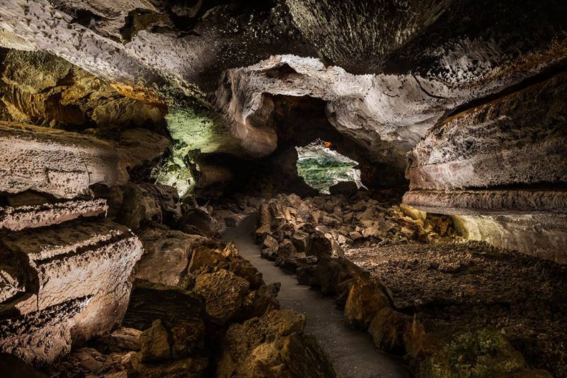
Cueva de los Verdes - Grot van de Groenen
La Cueva de los Verdes (The Cave of the Greens) is a volcanic structure located in the north of the Island of Lanzarote, in the municipality of Haría. It is part of the volcanic tube originated by the eruption of the Volcano Corona (Crown) and that gave rise to an extensive subterranean volcanic tunnel of more than six kilometers of length that runs from the volcanic cone to the sea.
A volcanic tunnel is produced by the cooling and solidification of the surface part of a lava wash in contact with the air as the molten magma of the interior continues to flow. The partial detachment of the roof of a section of this tunnel forms the structure called "Jameo", which is nothing more than the opening or mouth of the land that allows access to the different caves.
22-05-2017 Lanzarote Highlights
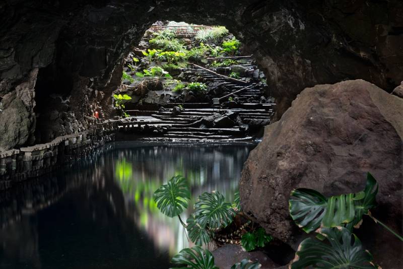
Jameos del agua
The word "jameo" is of aboriginal origin and refers to a hole that occurs as a result of the sinking of the roof of a volcanic pipe. The "Jameos del Agua", like the Cave of the Greens, are located inside the volcanic tunnel caused by the eruption of the Corona Volcano. The tunnel has a known length of 6 km, of which at least 1,5 km run under the sea surface, taking this last section the name Tunnel of Atlantis.
The Jameos del Agua are located in the section of this tunnel closest to the coast. It consists of at least three jameos or openings in the ground. The "Jameo Chico" through which access is made to the interior, the "Jameo Grande" and a third, called "Jameo de la Cazuela" (pot).
21-05-2017 Lanzarote Highlights
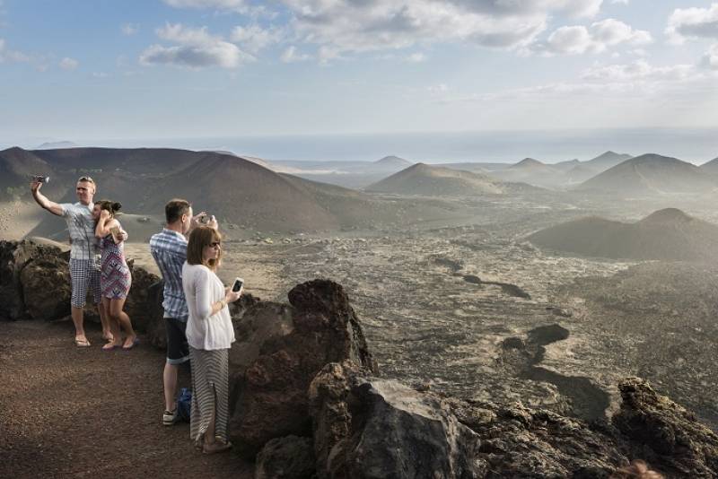
National park of Timanfaya
The National Park of Timanfaya is the only national park of the Spanish Network of National Parks eminently geological and represents a sample of recent and historical volcanism in the Macaronesian Region. The last eruptions occurred recently, in the eighteenth century, between 1730 and 1736, and more recently in 1824, gave rise to numerous geomorphological structures of high volcanological interest. In total it occupies an extension of 51,07 km² of the southwest of the island. The whole park is of volcanic origin, "the volcanoes of Timanfaya". Counting today with more than 25 volcanoes, being some emblematic, such as the "Fire Mountains", "Mountain Rajada" or the "Caldera del Corazoncillo" (little heart flower crater).
Latest posts

Aanbevolen excursies in Lanzarot...
20-07-2017
Excursie ten zuiden van Lanzarot...
20-07-2017
You would rather return to the h...
20-07-2017
Discover the awesome attractions...
20-07-2017